
From above, Aogashima looks like an island holding another small mountain inside itself. Steep outer cliffs surround a green basin, with an inner cone creating a striking double-caldera landscape.
It is part of Tokyo, although the setting feels far removed from the capital’s crowded streets. The people who live here are not characters in a story about “choosing to live dangerously”; they are a small community in a distinctive and demanding island environment.

A different geographical idea of Tokyo
GO TOKYO’s Aogashima guide places the island roughly 358 kilometres south of central Tokyo. It identifies the inner cone, Maruyama, and viewpoints that reveal the wider volcanic form.
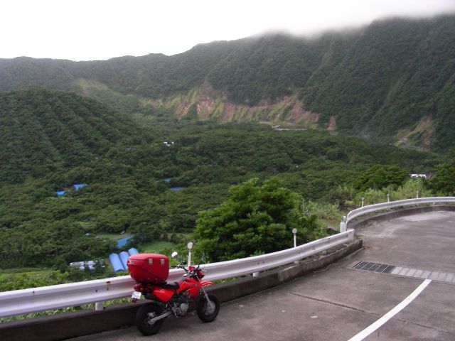
The aerial image is an excellent introduction, but the ground-level experience is different. Paths, slopes and viewpoints show portions of the landscape rather than the entire island at once.
A visit makes sense if that slower process interests you. It is less suitable if you expect to arrive, collect the aerial view and leave immediately.
Transport is part of the decision
Access is normally arranged through Hachijojima, with ferry or helicopter services subject to their own schedules and conditions. Check the actual service, booking method and baggage limits before making connected reservations.
Give the return journey a weather margin. A remote-island connection should not be treated as a guaranteed final step before a time-critical international departure.
Confirm accommodation before travelling, and ask your host how local transport and meals work. Limited choices can be part of the island’s appeal, provided they are understood rather than discovered as an unpleasant surprise.


Choose a few things to enjoy well
A viewpoint, a local meal and time outdoors can make a satisfying day. Check which paths are open and suitable, and follow local advice on weather and volcanic conditions.
At night, a dark sky can be a major pleasure when clouds and conditions cooperate. You do not need to promise yourself the Milky Way to enjoy the quieter surroundings.
Keep any photography within local rules. A dramatic drone-style image does not mean that launching a drone wherever you like is appropriate or permitted.
Be a guest in a small community
Use designated paths and facilities, carry out rubbish and respect private land. Ask before photographing people or entering places that are not clearly public.
If transport is disrupted, patience and a flexible plan matter more than trying to force the original schedule. Your accommodation can help explain practical options, but cannot control the sea or weather.
Our Kagoshima islands guide offers a broader way to compare southern Japanese islands. For another destination where limited capacity shapes the experience, see Lord Howe Island.
Aogashima rewards travellers who are interested in the island’s ordinary rhythm as well as its extraordinary outline.


Look beyond the outline of the crater
The archive includes photographs credited to mh2718 and izuyan, whose different viewpoints help move the story beyond its most famous aerial outline. An island seen from above can look like a self-contained bowl, but that image does not show where every home, road or facility sits. The older claim that residents all live at the bottom of the crater should not be inferred from the shape alone.
The inner cone, Maruyama, is a useful feature to locate when comparing a map with a photograph. Then look outward toward the enclosing relief and the steep coast. These are different parts of the volcanic landscape, and a ground-level view will reveal only some of their relationships at once. A viewpoint can explain the form without giving permission to enter every slope or depression visible from it.
The remote connections are part of the experience of Aogashima, not merely the journey before the interesting part begins. A visitor’s day depends on how accommodation, meals, transport and weather fit together, just as the island’s outline depends on more than its most photographed crater. Ask a host practical questions early and leave time to understand the setting from ground level. A map may explain the broad form, but a walk to an authorised viewpoint reveals it in stages. That slower encounter offers a fuller memory than arriving with only the aerial photograph in mind.
Sources, photography and further reading
Original feature and image attributions:
- mh2718
- izuyan
- theadventourist.com
- izismile.com
- Viral Nova
- Top 10 Stunning Volcanoes Around the World
- The Long Shadow of Mount Rainier
- Some Beautiful Crater Lakes in the World
- GO TOKYO’s Aogashima guide
- izuyan
- Kagoshima islands guide
- Lord Howe Island
Current reference information, checked 15 September 2026:


0 comments:
Post a Comment